


By Jack Voight, Sports Editor
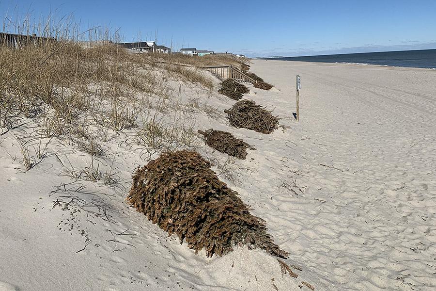
Outer Banks locals are no strangers to hurricanes. These storms cause millions of dollars in damage and bring swell for the avid surfing community, so most residents tune in during hurricane season so they know what is going on.
According to weather experts, this year is the most active hurricane season ever for the Atlantic – and it’s not over yet, with the season officially lasting all of October.
“The conditions are favorable based on past seasons that have similar characteristics in both the atmosphere and ocean to this year,” said Mark Willis, the Meteorologist in Charge for the National Oceanic and Atmospheric Administration (NOAA) in Wilmington, during a phone interview with Nighthawk News. “It has been trending to a La Niña even though it’s not a La Niña yet. That typically leads to more favorable upper-level winds over the Atlantic, which is favorable for hurricane development in the Atlantic basin.”
According to NOAA, the La Niña weather pattern features strong winds blowing warm water across the Pacific Ocean, causing cold water from the deep to rise to the surface near the coast of South America. This can lead to more tropical cyclones (including hurricanes) forming in the Caribbean.
This year already has seen the most hurricanes ever at this point in the season. And while some may be quick to pin the increase on climate change and temperature rises, Willis and other meteorologists have other reasons why trends like this take place.
That includes something quite technical called the Atlantic MultiDecadal Oscillation.
“You go through these naturally occurring phases for about three decades that are characterized by above-normal water temperatures and we are kind of at the end of that phase right now,” Willis explained.
But what does this all mean for the Outer Banks and future hurricanes?
Predicting hurricanes ahead of time is a bit of a shot in the dark, as it changes from week to week according to Erik Heden, a Warning Coordination Meteorologist for the National Weather Service out of Morehead City. He explains that although it’s too early to see storms coming, conditions are ripe.
“It’s like comparing golf, having one swing for a hole-in-one, but instead having 10 swings,” Heden said in a phone interview when asked about hurricane chances this fall. “Still a low chance, but you have more swings.”
In other words, more hurricanes forming in the Atlantic means a greater chance that one will reach the OBX.
What residents do know is that the chances are higher than ever, and that being prepared is essential during times like this. Heden encourages residents from the Outer Banks and beyond to take this into consideration.
“Knowing and having a hurricane plan in place is important,” Heden said. “The preparedness aspect is key. Have the supplies to last a few days if the storm does come around, or an evacuation plan.”
Heden also reminds people about the common misconceptions when it comes to categorizing hurricanes.
“The category of the storm doesn’t necessarily mean how bad it will be,” Heden said. “It doesn’t include storm size, storm surge or rainfall, which all play a huge role in how bad it can be. For example, just last year Ocracoke got hit by Dorian, which was a Category 1, but they had a terrible storm surge. So, don’t always focus on the category.”
Senior Jack Voight can be reached at 21voightja99@daretolearn.org.